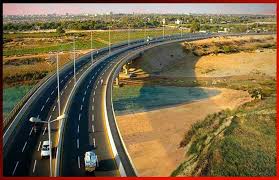
Malir Expressway Map — Complete Guide to New Karachi Express Route
The Malir Expressway is one of the most important mega-projects in Karachi, designed to improve travel connectivity and provide a fast route from Karachi City to M9 Motorway. If you are searching for an updated Malir Expressway Map, route details, one of the , and development updates, you are in the right place.
✅ What is Malir Expressway?
Malir Expressway is a 39 KM long high-speed express route currently under construction in Karachi. It aims to reduce traffic burden from main city roads and provide quick access between:
-
Korangi
-
Shah Faisal Colony
-
Malir
-
M9 Motorway (Hyderabad-Karachi Motorway)
It will also improve travel time to DHA City, Bahria Town Karachi, and New Karachi suburbs.
📍 Malir Expressway Map & Route Alignment
The expressway starts from Korangi Creek Avenue and ends at Kathore Interchange on M9. Key points along the map include:
| Route Section | Notable Locations |
|---|---|
| Starting Point | Korangi Creek Avenue |
| Main Corridor | Along Malir River |
| Mid Route | Qayyumabad, Malir Halt, Malir 15 |
| Ending Point | Kathore Interchange on M9 |
The route will include:
-
4 major interchanges
-
Dedicated entry/exit points
-
Protected service roads
The expressway runs parallel to the Malir River, offering a direct corridor from industrial zones to highway routes.🚘 Travel Time After Completion
| Current Travel Time | Future After Expressway |
|---|---|
| 1 Hour + Traffic Jams | 25 Minutes Only |
This will help businessmen, daily commuters, and transport vehicles move faster.
🏗️ Development Status & Progress
-
Construction in full swing
-
Expected completion soon
-
Government + Private PPP model investment
-
Smart monitoring & strong road foundation planned
This project will boost the real estate value in surrounding areas such as:
✅ Malir
✅ Korangi Industrial Area
✅ Shah Faisal Colony
✅ Memon Goth
✅ Karachi-Hyderabad Corridor
📈 Future Benefits of Malir Expressway
-
Rapid access to M9 Motorway
-
Reduced fuel consumption and travel cost
-
Strengthen Karachi commercial network
-
Better logistics for industries
-
Job creation & local economy boost
🗺️ Why People Search “Malir Expressway Map”?
Because buyers, investors, and commuters want to know:
✔ How far is the expressway from their location?
✔ Where are the entry/exit points?
✔ Which real estate areas will benefit?
✔ What is the completion timeline?
This shows how important this project is for Karachi’s future mobility.
📢 Final Words
Malir Expressway Map is a key search because it highlights the future of Karachi’s infrastructure growth. This modern express route ensures smart, fast, and safe travel — connecting the city core directly with the motorway.
Keep following the latest updates and always check official channels for the newest route changes and progress reports.